Heavy Rains and High Water
O'Brien county, Iowa
“Floods of 1954 in Iowa,” part of a broader report by the US Geological Survey, records some heavy rains in northwest Iowa from June 15-17 in 1954. Subsequent June rains in central Iowa along the Des Moines River, where there was more built property to flood and people to inconvenience, may have caused heavier damage. But the total rainfall in parts of northwest Iowa, including O’Brien County, was five and six inches. 1953 had been a wet year for Iowa as well.
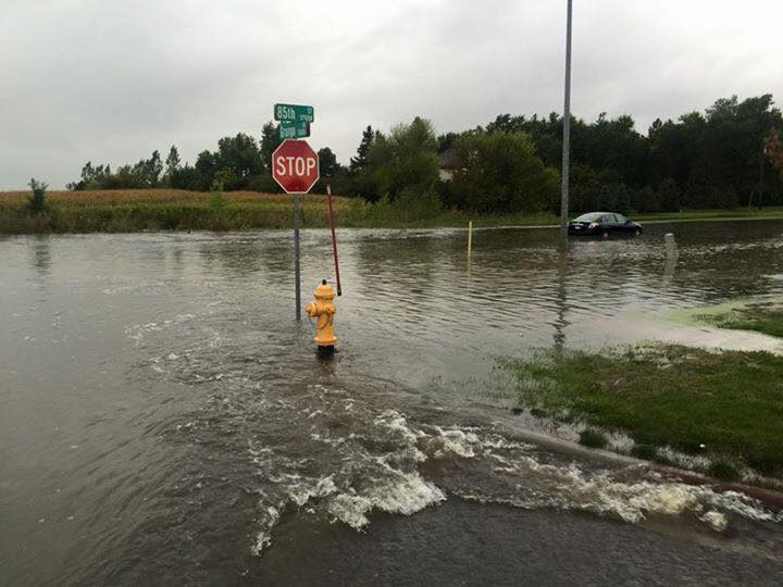
A September 16, 2016 substantial rainfall put Hartley in particular on the Iowa flood maps for that flood-prone year in the state, one of many such years in the last decade. Though the National Weather Service official count was 5.45 inches at Hartley, the most in O’Brien County, some residents with flooded streets and basements reported as much as 7 inches on their own rain gages. Ken Master, a technician with the National Weather Service, said the next day, “We just had a low pressure system moving across the area with abundant moisture and it brought up a lot of moist air out of Nebraska — out of the southwest — and it kept reforming over the same areas storm after storm after storm. It just all accumulated together and kept raining and raining and raining.” Jared Johnson, O’Brien County Emergency Management Agency director, said it was a long night in Hartley with the city workers and residents using pumps trying to protect individual and city property like the waste water plant. With the storms reforming repeatedly overhead, flash flood warnings were in effect in the region. But Hartley got the worst of it that time.