Floods of 2008 and New Flood Maps
Henry county, Iowa
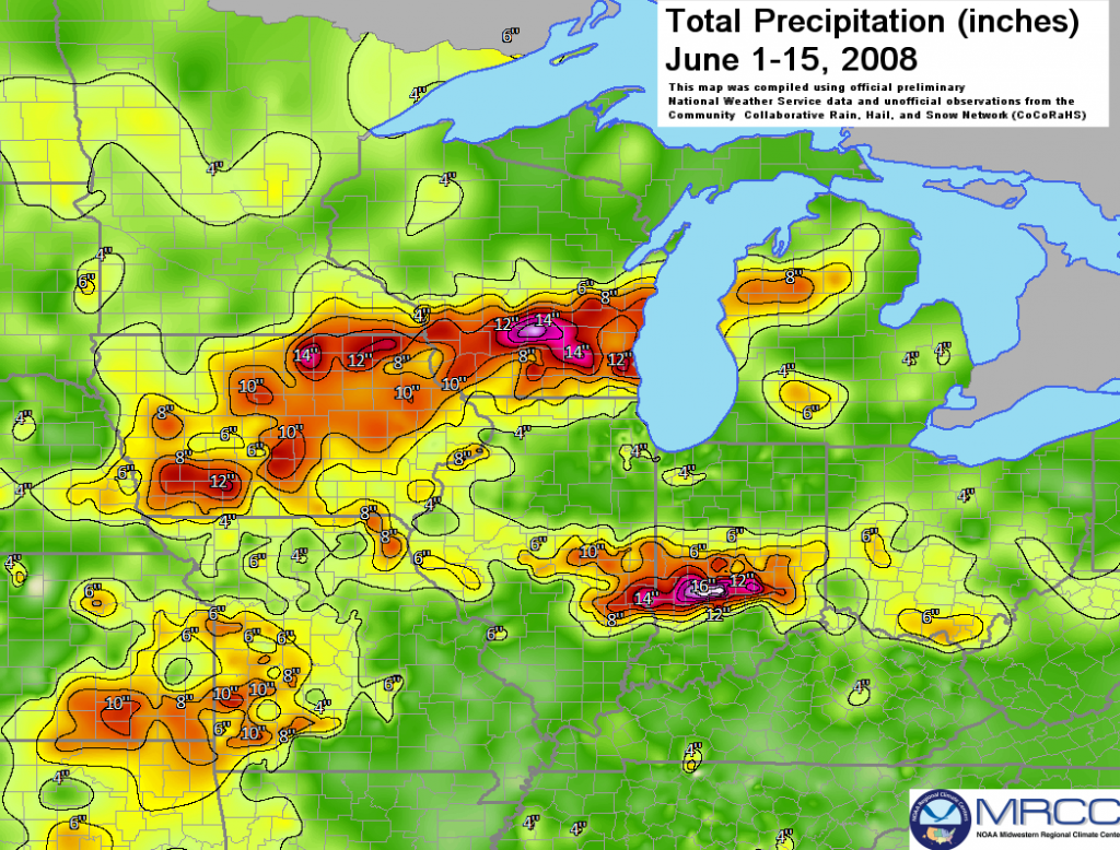
Like much of the rest of Iowa, Henry County faced significant flooding in the summer of 2008. While there was minimal damage to homes compared to the other counties, Henry County suffered substantial crop losses and thousands in road damages.
“Our yields are definitely going to be down this year,” said Jim Jensen, farm management specialist with Iowa State University’s Henry County extension office. The floods damaged as much as 15 percent of the county’s crops. However, the crops were already suffering from what Jensen described as an “erratic winter and wet spring.”
Jensen explained that the problem does not disappear when the water recedes. “If the roots are surrounded with water, that can almost be as bad as if they’re covered up.” Areas of pothole-like depressions slow the drainage of much of the area’s farmland. Otherwise, much of the flooding was contained to near the Skunk River and the Mud and Crooked Creeks.
Jensen continued to explain the county’s problem. “We don’t have everything planted yet, especially in the southern part of the county…We started off in a hole there; then we had this flooding that added to this problem… We don’t know how well they’re going to come through this.”
The floods of 2008 highlighted the often-unpredictable nature of farming. “If you compare where we were this time last year, we’re a lot off from the kind of corn and soybean crop we had going last year,” said Jensen. “Of course, last year was a good year.”
After the flooding, Henry County shifted focus to rebuilding. County Engineer, Bill Belzer, estimated the road damages would cost the county more than $50,000. The Oakland Mills Road, which spent several days underwater, drove up the losses due to the heavy erosion the road sustained.
After the flooding, a FEMA grant allowed the Iowa DNR to map Henry County’s flood risk. The new 100-year flood plain would come into effect in the fall of 2019.
Joe Bluffington, County Planning and Zoning Administrator, commented that the project is “a good planning tool for us to keep people out of the flood zone in the future.”
Henry County was previously not an area of focus for new mapping. A low population and flooding risk didn’t make the county a priority for the DNR. That changed after the 2008 floods.
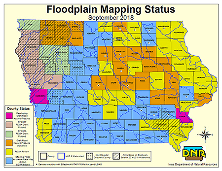
Chris Kahle, DNR GIS Lead, estimated that only 10 to 15 properties in the county are within a flood zone. According to Kahle, in the past, people would build farther uphill to avoid the costs and resources associated with rebuilding after a flood. As time progressed, people began to build closer to the flood plain. However, Henry County still has a relatively low population within the flood plain.
“We want the community to take ownership of these maps,” said Kahle on the project during an open house in Henry County. Residents were encouraged to ask questions and engage with what the new flood plain meant for them.
Sources: Erik Owomoyela, “Floods make bad year worse for county crops,” Mt. Pleasant News, 2008; “Flooding in county may merit emergency funds,” Mt. Pleasant News, 2008; Grace King, “Henry County being mapped for 100-year flood plain,” Mt. Pleasant News, 2018; Jeff Hunt, “Flooding reported in Mt. Pleasant Area,” Mt. Pleasant News, 2008.