21 st -Century Cold in Allamakee County—Thundersnow and Polar Vortex
Allamakee County, Iowa
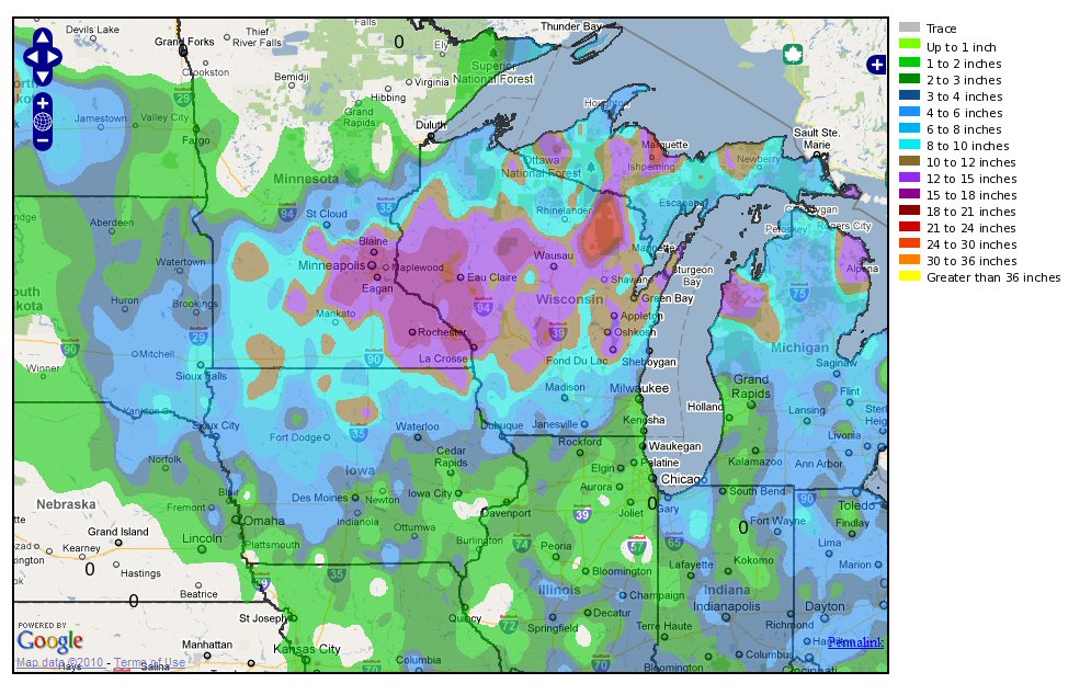
December 10 and 11th of 2010, twelve inches of snow accumulated in Waukon, the most in the county and in the state. More than twice that much fell over the border in Minnesota and the storm developed, in the Northeastern part of the US, into a huge nor’easter as it joined forces with another storm on the coast. This storm, as had one in 2006, and one in November 2018, produced thundersnow, that is lightning and thunder accompanying a snow storm. The conditions that produce thundersnow are—or have been—exceptional as the causes of a thunderstorm and of a winter snow storm are ordinarily quite different. But in the twenty-first century thundersnow seems to be less rare than it once was. The polar vortex, in comparison, is not rare at all, not at the poles. It is an intense pocket of cold air—more intense in winter—that is almost always at the Earth’s poles. Except sometimes of late atmospheric conditions warm up the North Pole and that polar vortex slips down into Siberia or North America. For example, in December 2016, there was an Artic heat wave with temperatures 50 degrees F. above normal. The intense Arctic cold fell into Siberia giving people there a very cold December. In 2014, in January, warming at the North Pole destabilized the vortex and sent record-setting frigid air into North America. February 25-27, 2007, saw the second highest accumulation of snow in Allamakee county records: 16 inches at Lansing and more in Dorchester. Two blizzards with a sleet storm in between made conditions dangerous. This storm was also accompanied by lightning.

Sources: NOAA/National Weather Service, Natural Hazards Assessment: Allamakee County, November 2016; “Explainer: What is Thundersnow,” Science News for Students, 2018, web; Brian Kahn, “North Pole Temperatures May Soar to Fifty Degrees Above Normal,” Scientific American, 21 December 2016, web.
